I had planned to write this Trip Report to give a taste of
what I really train for: overnight “raids” into the back country. That didn't play out so well this time, but I think the story can serve as a reminder to
think about safety margins and decision-making on the trails.
The plan was to set out into the Desolation Wilderness
southwest of Lake Tahoe. Saturday would be a 18-mile fish-hook from the trail head at Echo Lake past Lake Aloha, up Mosquito Pass, down Rockbound Valley, up to Velma Lakes and then a loop back up
to Dick’s Lake. Sunday would complete the circle in 19 miles, using the Tahoe
Rim Trail and a detour to Half Moon lake for lunch.
 |
| Desolation Wilderness. Planned Route in black. Exit in red. |
My backback weighed in at 26lbs before I added cheese,
hot dogs and bear spray. That would allow to me run slowly on the flat and
downhill, but only up the slightest inclines.
Starting out, my main worry was the heat. As I was driving
from San Francisco through Central Valley, the top temperature was 111F.
Forecast for Lake Tahoe at lake level (6200 feet) was 93F for Saturday and slightly lower but
a chance of thunderstorms on Sunday evening. That’s pretty high for someone who
lives in 53F and fog for seven months every year.
 |
| Echo Lake Marina |
After a huge and somewhat late breakfast, I took off from
Echo Lake at 0830, and made good progress toward Lake Aloha. I passed a bunch
of people which always is strangely satisfying given that they in no way are
trying to compete with me. The views were absolutely stunning, and Lake Aloha
is a place I absolutely need to return to. I had only seen it in winter, when I
climbed Pyramid Peak.
 |
| Lake Aloha with Pyramid Peak in the background. I had only seen Lake Aloha in the winter, when I climbed Pyramid Peak on skis. |
 |
| Lilies by Lake Aloha |
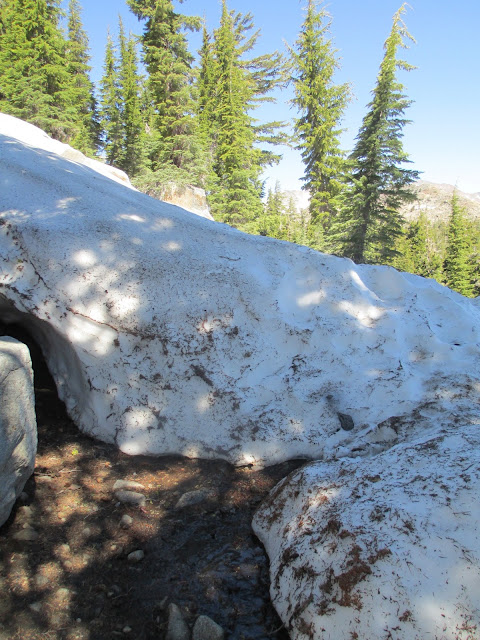
Soon, increasingly large snow patches were covering the
trail, and I managed to get off trail for 30 minutes. When I run on trails, I
too often become sloppy and hand over the navigation to the trail. Ending up on
the wrong side of a ridge just shouldn't happen – they are very evident on the
map.
 |
| Where did the trail go? |
 |
| Trail and lake on the other side of the ridge - sloppy! |
I was also worried about stepping through the snow and
hurting my foot on the rocks below, so I was very careful near the edges of the
snowpack.
Around 1045, I reached the end of Lake Aloha and started
climbing toward Mosquito Pass. I was relieved to get off the Tahoe Rim Trail as
it feels too engineered and crowded. It is great for scenic running, but it
doesn't give me the wilderness vibes I’m looking for on these trips.
I was debating with myself whether I should stop for lunch
at the top of the pass or press on down through Rockbound Valley when my right
foot suddenly went through the snow pack. All 220 lb of body and backpack landed
on a sharp rock underneath. I felt the impact when the stuff inside the top of my foot banged
against the lower parts of the shin. It hurt quite a lot, but in my experience
these things go away after a while in 9 of 10 cases.
 |
| Treacherous snow pack on top of Mosquito Pass. Rockbound Valley ahead. |
At least the lunch question was settled: I sat down in the
shade, turned on my Jetboiler, and made some delicious noodles with hot dogs. I
admired the view, munching crackers with artisan cheese when a runner came
sliding by on the snow pack. We chatted for a while, both of us regretting leaving our sunglasses in the car. A cap works great in most
cases, but when you are running on snow, at high altitude, on a clear day, in
the middle of the summer, at a latitude corresponding to southern Spain, you
really do want sunglasses. The runner was aiming for a 30-mile out-and-back, so
I showed him the loop I had planned. I think we went for that option, because I
never saw him again.
I finished my lunch quickly. I was in
competition mode, and wanted to see how fast I could get to my night camp by Dicks Lake
When I put weight on my foot my knee almost buckled from the pain. I told
myself it would get better when it warmed up, and it actually did. The trail
conditions were pretty challenging on the descent, with lots of snow, running
water, and rocks. I still ran some of, but was a bit bummed because I love
running downhill and had thought this part of the trip would be five gently
descending, eminently runnable miles.
 |
| Trail part 1 - straight ahead to Rockbound Valley |
 |
| Trail part 2. Yep, this is the trail. |
 |
| Trail part 3. |
On the valley bottom, the trail was quite
faint and crossed the river many times. There wasn't that much undergrowth, so
it wasn't a big deal to lose the trail. I just needed to stay in the
valley until the mountain on the right opened up into a pass, and a stream
descended from the left.
Somewhere here, my foot started to hurt. A lot. I had been
compensating for the injury with all the other muscles that were available, but
they now cramped up and went on strike. Every muscle from the calf down was
rock hard and hurt. The banging and ankle-tilting of going off-trail had
certainly added to it.
The river I was following is named the Rubicon River, which is ironic. Just like Caesar was committed when he crossed the Rubicon back in 49 BC I was committed when I crossed the Rubicon of Rockbound Valley: the shortest way out was forward.
I was considering stopping for a while to see if things would get better, but in my experience they seldom do with foot injuries. The swelling can just get worse from sitting still. Normally, I would wrap a foot like mine quite tight, but I was thinking that my compression socks would do that job. Also, I really didn't want to stop because of the mosquitoes. They were relentless, and even a five-second stop had a hundred of them biting me
everywhere. Those bastards love compression socks: they can bite through the
socks, but you can’t feel them sitting there. EDDT is your friend, but it needs
to be applied to the skin, so it wasn't much help.
As I hobbled along,, I was very happy I had brought bear spray.
This valley is prime bear country: high brushes, plenty of water and berries.
Every river crossing was a relief: the cold helped my foot, cooled me off, and
relieved the mosquito bites.
 |
| Rubicon River |
 |
| Rubicon River again |
 |
| And again |
Around 1400 I got to camper flat, which was a great relief.
To the east, a wide pass was looking down on me, and I would get to climb away
from the damn mosquitoes. Climbing up the granite fells was probably the worst
part of the trip. Granite is hard, and the trail was uneven. I made
really slow progress, and it took me two hours to climb the two miles up to the
Velma Lakes. I was also getting worried about the state of my
foot. Pain is one thing, but I was getting worried about long-term injury. I was twisting my foot outward, and was pushing on the outside of it a lot. I started thinking I could be hurting the the fifth metatarsal bone or the abductor digiti minimi. I have lost
enough time to injuries the last few years, and I really want to continue ramping my running volume like I’ve
been doing the last few months.
Somewhere around this time, I realized I needed to change my plans. Going toward Dicks lake would be a bad idea. With
23 miles to go back to the car, at 1 mph, I wouldn't make it even if I
walked all day Sunday. I'm not sure why this didn't occur to me earlier, but it didn't matter because there was no decision to be made until I had made it out of Rockbound Valley.
Examining at the map, my best options were to go to the Bayview campground or Eagle
Falls trail head. I needed to decide which one, and also whether to camp
on the mountain or to try to make it down that day. I wasn't thinking clearly
enough to make those decisions, so I decided to stop for dinner.
I found an amazing spot by Lower Velma Lake, and made some Ramen and hot dogs. For the first time I took the sock off to look at the foot.
It looked pretty OK, and was most sore on the top right, which corresponds to a
normal sprain. This confirmed my hypothesis that compression socks do a good
job of limiting swelling from sprains.
 |
| Velma Lake and the foot. Yes, that foot. |
Time to decide what to do: try to get out, or camp in this
awesome spot overnight? For many, that would be an easy question. They
would just stay and enjoy the view. For me, it wasn't that clear. I can only
sit and do nothing if I’m totally exhausted. Although I was in pain, the pace
had been so low that I still had enough mental energy to become severely bored. There was only going to be the mosquitoes and I for five hours until I would be able to sleep.
In my experience, sprains don’t really get better over the
first night, and may actually become worse when you relieve the pressure. Also,
the thought of sleeping in a real bed was honestly pretty compelling. I decided
that if I thought I could make it out safely, I would.
It was 1720, so I had three hours of sunlight plus maybe
forty five minutes of afterglow to go before darkness. The shortest way out was
3.5 miles to Bayview, which included a 1500-foot steep and potentially rocky
descent. It would be stupid to try that in the darkness. I had been doing 1 mph the last two hours, so I could
really not be sure I would make it.
I decided to conduct an experiment: measure the pace over
the next segment of trail and then make a decision. Luckily with food and rest
my pace had picked up, and I did 2 miles in “only” 1:15. For this segment I found a good and steady branch to take some pressure off the foot. I got some pretty
good hand blisters, but it was clearly worth it.
The final descent was as steep as expected – about 1500 feet in a half mile. Luckily it wasn't rocky. I moved very
slowly, but reached the campground just as the sun started to set.
 |
| Halfway down to Bayview |
Now I just needed to find a ride to my car. I quickly found
the campground manager’s trailer and knocked on his door. The dude’s half-deaf
and rowdier cousin emerged. I told him that I hurt my foot and had to exit to
the wrong trail head. Was there any chance he could help call a cab?
- “A cab, umm… I don’t know how to do that? Do you have the
number?”
- “No, but maybe we could call 411? “
- “Hmm. Have you tried hitchhiking? Do that while I finish my
dinner and then I’ll see if I can help you.”
I walked up to the road and put my thumb out. Ten cars
passed, but no-one stopped. After a while, an SUV stopped off the road in a
parking area. I decided to ask them for a ride, and they offered me a place in
the trunk if I was OK with waiting until after they had finished watching the
sunset. The people in the car were two well-kept couples in their early thirties, and I had both bear spray and a study knife, so I jumped into the roomy trunk and struck up a conversation.
After three minutes of chatting, the dude’s cousin comes
walking. He’s looking for me, and ask the people in the SUV if they have seen a
hitchhiker. I can imagine they were getting worried. Why would this hairy cowboy be looking for the guy in their trunk? It turned out he just wanted to
offer me a ride to a nearby restaurant, where they called a cab for me. That was very nice of them considering I was filthy and stank, and all their customers
had cocktail attire. The cab was cash-only, but luckily I had $100 with me
(along with ID and credit card) just for situations like this one.
The cab dropped me by my car. I then drove down to South
Lake Tahoe where I ate two Big Macs and went straight to bed.
There were a couple of decision points here that I’d welcome
discussion around:
- Continued after initial
bruise.
- Didn’t turn around in
Rockbound Valley
- Didn’t proceed to original
campsite by Dick’s lake
- Didn’t camp by Lower Velma
lake
- Hitchhiked with the dude’s
cousin
Personally, I’m glad that I got out safely. My safety
margins were sufficient for a minor incident like this. Spraining an ankle is
something that can happen every time we hit the trails, and it is really useful
to think through what you do if it happens. I try to plan so that I can survive
a broken leg and at least two additional days in the wilderness. The only real lesson I've drawn this far is to be more disciplined about stopping and bringing the map out when I lose the trail. Maybe I will figure out more improvements to SOP and packing over the days to come.
Also, I learned that I will not be returning to the Lake Tahoe area for
wilderness experiences – the space is too small and there are too many people.
The trails are wonderful for running, and that’s what I will do there.
I will return
to do this loop, but it will be as a day trip with a light pack. The trails
definitely are sufficiently runnable (except for 2-3 miles in Rockbound Valley), and the climbs are quite gradual.


